|
Welcome to the Gulf of Maine CODAR Page at the University of Maine Physical Oceanography Group School of Marine Sciences University of Maine |

|
Welcome to the Gulf of Maine CODAR Page at the University of Maine Physical Oceanography Group School of Marine Sciences University of Maine |
 |
 |
 |
|
Coastal Ocean Dynamics Applications Radar, or CODAR, is a land based high frequency (HF)
Radar system used for measuring sea surface current. Measurements can
be made at long range, across wide areas, using a single instrument.
The Gulf of Maine CODAR stations (supported by NERACOOS) use Long-Range SeaSonde, an instrument anufactured
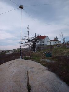
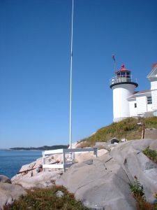
by Codar Ocean Sensors. The photos
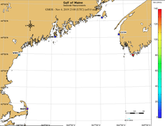
above show a receiver antenna (left), a transmitter antenna (right) and
an image of a current vector map produced from data collected at two
CODAR stations (center). Click the center image to view the
latest total vector plot. The University of Maine maintains, operates, and distributes data to the national HF-Radar network from their three long-range HF CODAR stations in the Gulf of Maine. The sites are located on Greens Island in southern Penobscot Bay (mid-coast Maine), Grand Manan Island in New Brunswick, and Cape St. Mary in southwest Nova Scotia. A data-sharing partnership has been set up with OEA Technologies in Halifax, Nova Scotia to provide expanded coverage of the eastern Gulf of Maine region with their site at Clarke's Harbour in southern Nova Scotia. Data from these sites are being used to provide synoptic surface current information to the Canadian Forces Meteorology and Oceanography Centre, Halifax and the Joint (Canadian Coast Guard/Canadian Forces) Rescue Coordination Centre (JRCC)in Halifax and its partnering agencies. |
| Site | Name | Latitude | Longitude | Status | Latest Event | Comments |
|---|---|---|---|---|---|---|
| Cape St. Mary, Nova Scotia | CSTM | 44 05.2 N | 66 12.7 W | Fully Operational | 2012-06-17 | Performed Antenna Pattern Measurement, and installed new pattern. |
| Grand Manan, New Brunswick | GMNB | 44 36.0 N | 66 54.3 W | Fully Operational | 2015-06-24 | Reset Ethernet Power Switch to restore Comm's |
| Greens Island, Penobscot Bay, Maine | GRNI | 44 01.5 N | 68 51.6 W | Fully Operational | 2013-07-16 | Ran OSX Updates |
| NERACOOS Home | Latest Buoy Data | U.Maine Buoys | U.Maine CODAR | GOM Weather | GOM Wave Modeling | Related Links | Software | Mooring Group | PhOG home |