 |
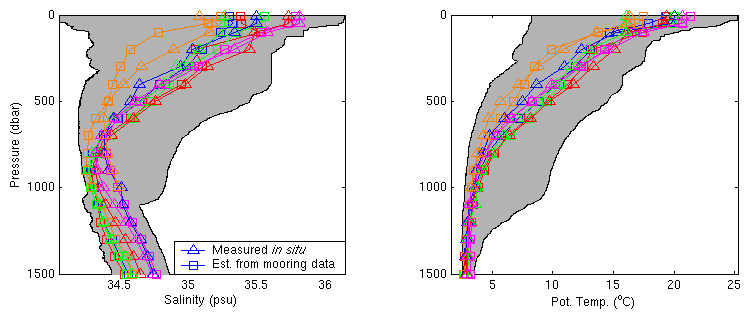
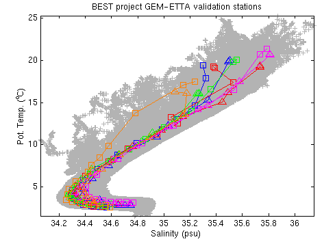
Figure 19 a,b,c. Five GEM-ETTA estimates from the BEST project. In the middle of the BEST deployment, a hydrographic station was occupied at the location of each mooring. These five stations are now used to test the GEM-ETTA method. Gray shapes outline the total range of all hydrographic data from the Cape Basin database for which measurements extended to 1500 dbar. |
a) (top left) Salinity with depth. A large error in the salinity estimate for the station occupied at the location of SN 62 is visible (orange triangles versus orange squares).
b) (top right) Temperature with depth. The temperature parameterization appears to have been more successful than that of salinity.
c) (bottom left) The same data in T-S space.