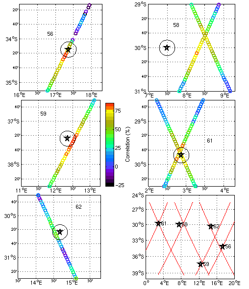
a) (top left) Spatial pattern of the correlation of TOPEX timeseries with BEST mooring SN56 timeseries. A 20 km range ring is shown for scale. Mooring data were lowpass filtered with a 40-hour window. TOPEX sea level data have an annual mean and tide removed, as well as standard atmospheric corrections.
b) (top right) Correlation of TOPEX timeseries with BEST mooring SN58 timeseries. Note that because of the O(100 km) distance between this mooring and the nearest TOPEX groundtrack, both the altimetric and mooring timeseries were lowpass filtered with a 3-day window. In addition, the mooring times were lagged by 8 days to produce a good qualitative correspondence between major mesoscale events in the respective records.
c,d,e) (middle left, middle right, bottom left) Correlation of TOPEX timeseries with BEST mooring SN59, SN61 and SN62 timeseries, respectively. Processing as in a). The vertical colorbar between Figs. 7c and 7d is valid for all of the correlations displayed in this figure.
f) (bottom right) Map showing relative locations of the BEST IES moorings and nearby TOPEX groundtracks.