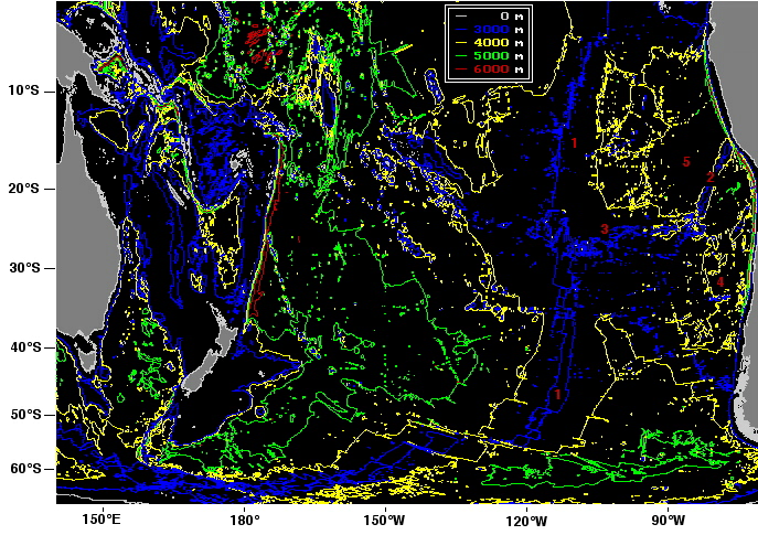
Access to the deep basins of the South Pacific Ocean is not restricted in any major way, so Antarctic Bottom Water can enter everywhere and proceeds northward in all basins. This is particularly true west of the East Pacific Rise (1), where the ocean depth is very uniform over large regions.
(Map based on the GEBCO97 database, produced with GEBCO97 software and modified.)
The Nazca Ridge (2) and the Salay Gomez Ridge (3), which connect the East Pacific Rise near Easter Island with the South American shelf, divide the eastern abyssal plain into the Chile Basin (4) in the south and the Peru Basin (5) in the north.
Further north, another broad ridge system (just visible in the upper right of the map, north of the Peru Basin) isolates the deepest depths of the Panama Basin (north of the map area) from the remainder of the Pacific Ocean. Although not as deep as ocean trenches, these basins contain some of the least ventilated water of the world ocean. The Panama Basin is so stagnant at depth that it is one of the few places of the world ocean where the effect of geothermal heating is measurable. The rise in temperature produced by heating from the earth's interior is 0.3°C.