Exercise 1: Map projections as essential tools of physical oceanography.
Page 2
A map is more than an instrument for the display of information. It reflects the knowledge about the earth's surface at the time of its design. Once established, it takes on a life of its own and begins to influence peoples' perceptions of the world. Here are some famous examples of maps that dominated the view of the world for centuries:

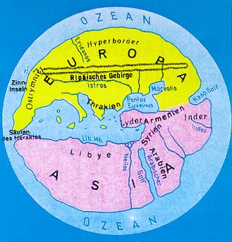
This map of the Greek philosopher Hekataios (shown here in a German reproduction) represents the Mediterranean view of the earth at 500 B.C. Europe, Asia and Lybia (Africa) are arranged around Hekataios' birthplace Milet in the centre. |

This map (also shown in a German reproduction) was made by Al Idrisi, an Arab who lived at around 1200 A.D. It places the prophet's birthplace Mecca in its centre. |

The London Psalter Map from the 13th century (again shown here in a German reproduction) is an example of the mapping tradition of the Catholic Church. It puts Jerusalem and Bethlehem in the centre of the world. |

This map of the Italian Hieronymus Marini was produced in 1512, after the American continent became known to the Europeans. It shows a larger part of the world but keeps with the Christian tradition of placing Jerusalem in its centre.
|
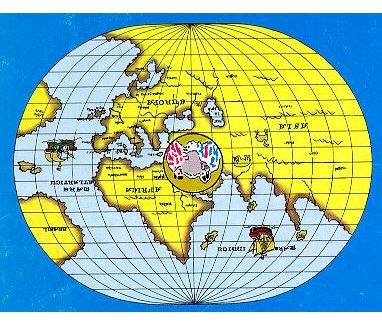
The widespread use of maps that do not maintain fidelity of area can lead to serious errors of judgement about the true size of countries and continents. Here is a small test of your own geographical perception of the world. How does North America compare in size with Africa? Select (click on) the button that, in your view, shows the correct answer:
North America (Canada and the USA, including Alaska) is ...
You have the option to look at a map of the world; but do not be misguided by what you will see!

 © 2000 M. Tomczak
contact address:
home page: http://www.es.flinders.edu.au/~mattom
web address of Exercises in Oceanography: http://www.es.flinders.edu.au/~mattom/IntExerc
This page last updated 5 December 1999


