RMRP 1995
Experiment Location
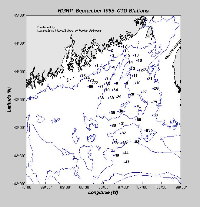
This experiment primarily focused its efforts on the coastal and near-coastal
waters of the Gulf of Maine.
Cruises:
- April 2-4, 1995 (RV ARGO MAINE)
- June 23, 1995 (RV ARGO MAINE)
- Moorings: COAS-2 and JORD-2 moorings deployed
- July 10, 1995
- September 6-10, 1995 (RV ARGO MAINE)
Moorings
Description:
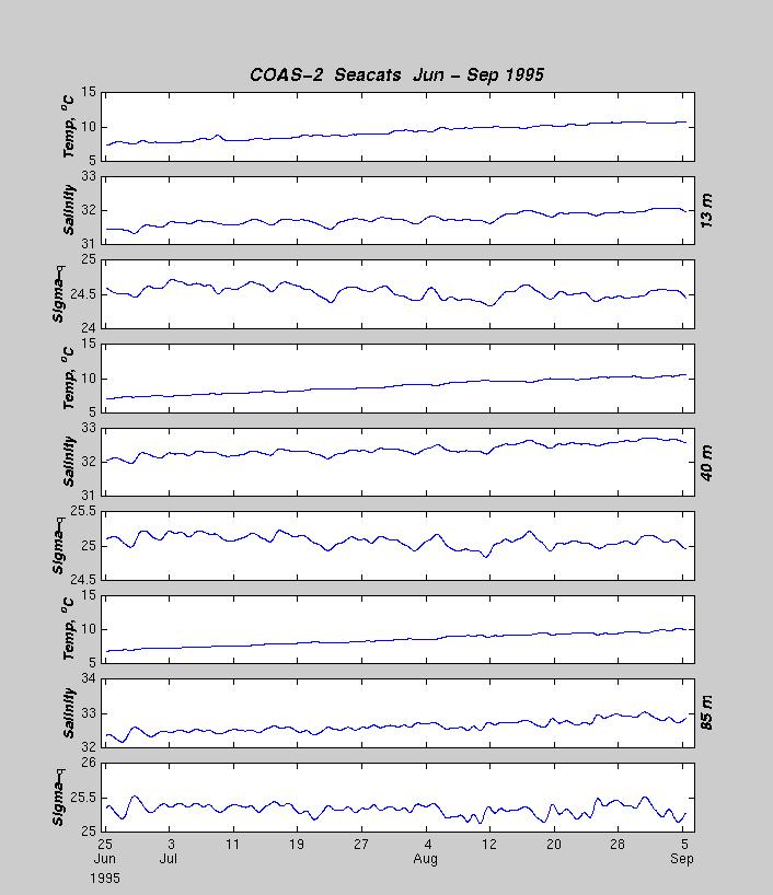
During 1995, the University of Maine deployed two inverse-catenary moorings, one within the 100 meter
isobath (COAS-2) and one within the 200 meter isobath (JORD-2). These
moorings were designed to sample the water column at discrete time intervals and
average the data to half-hourly values using 150 kHz ADCPs manufactured by
R.D. Instruments, Inc.
Seabird Seacat T/S instruments were attached
to the mooring wire near the surface at 3 depths on each mooring and sampled at
a rate of one sample every 5 minutes. The seacats
were attached at depths of 13, 40, and 85 meters on COAS-2 and at depths of 75,
125. and 191 meters on JORD-2.
The moorings were deployed on the RV ARGO MAINE
in June 1995. The JORD-2 mooring was trawled on 8 July and was recovered on 10 July. The COAS-2
mooring developed doppler battery problems and the mooring was recovered and
redeployed with a new doppler on 8 August. Doppler data from COAS-2 is available
from 8 August through 10 September 1995 when the mooring was recovered.
The mooring locations are as follows:
| BUOY | Data | Latitude | Longitude |
Depth | Deploy. Date | Recov.Date | Comments |
| COAS-2 |
Vel,T/S
| 44° 17.09´N | 067° 40.72´W | 94m |
23 Jun 1995 | 10 Sep 1995 | OK |
| JORD-2 |
Vel,T/S
| 43° 57.17´N | 067° 44.72´W | 194 m |
23 Jun 1995 | 10 Jul 1995 | Trawled 8 July. |