| Event | Date | Time UTC | Latitude | Longitude | Depth | Location |
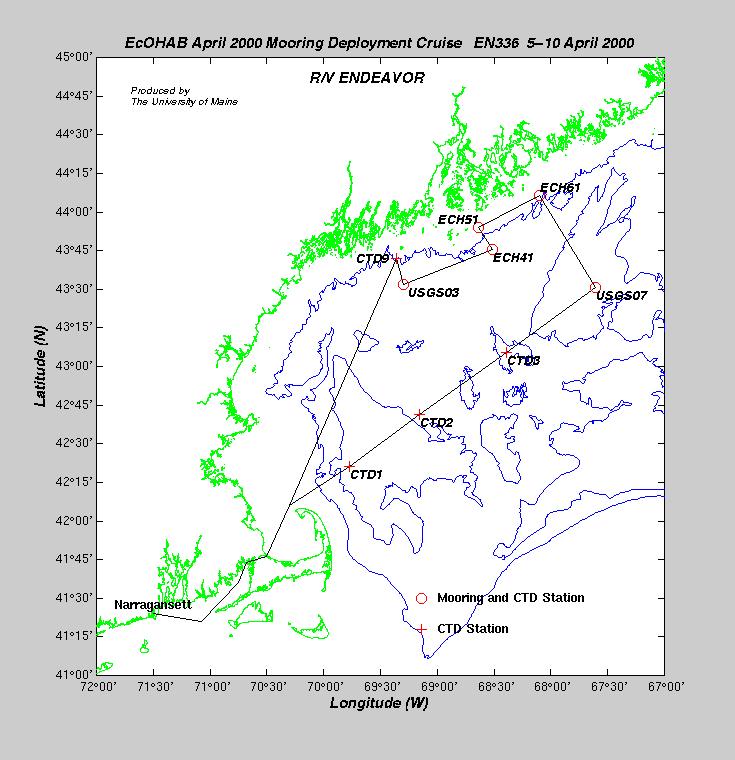
| Depart Narragansett | 04/06/00 | 13:12 | - | - | - | Start of EN-336 |
| CTD1 | 04/06/00 | 22:44 | 42° 21.100´N | 69° 46.590´W | 256.0 | Wilkinson Basin |
| CTD2 | 04/07/00 | 02:30 | 42° 41.180´N | 69° 09.280´W | 162.0 | Mid Gulf |
| CTD3 | 04/07/00 | 06:54 | 43° 05.610´N | 68° 23.680´W | 219.0 | Mid Gulf |
| CTD4 | 04/07/00 | 11:04 | 43° 30.620´N | 67° 36.670´W | 227.0 | Jordan Basin |
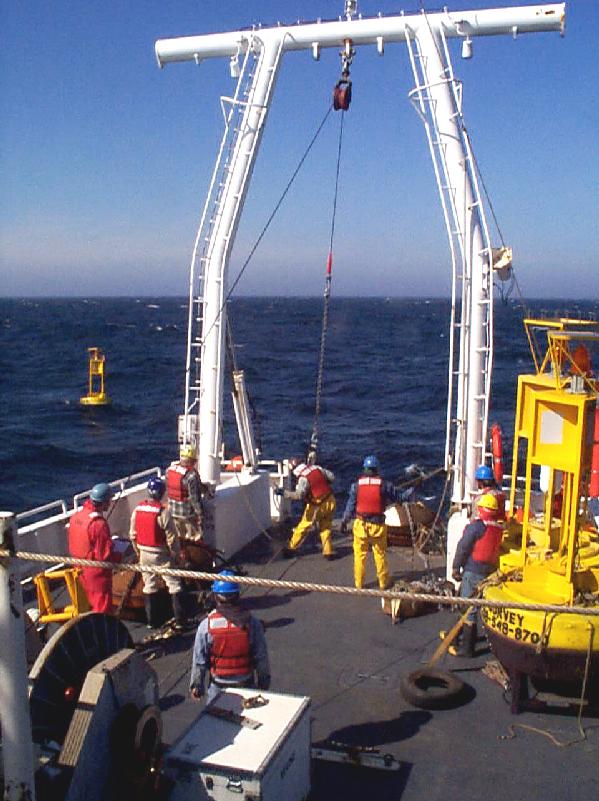
| USGS07 Mooring | 04/07/00 | 14:14 | 43° 30.773´N | 67° 36.701´W | 236.4 | Jordan Basin |
| USGS07 Mini-Pod | 04/07/00 | 15:40 | 43° 30.834´N | 67° 36.684´W | 236.4 | Jordan Basin |
| DRIFT1 | 04/07/00 | 19:00 | 44° 00.000´N | 68° 00.000´W | 152.0 | EMCC Offshore |
| CTD5 | 04/07/00 | 20:38 | 44° 06.420´N | 68° 06.000´W | 96.1 | EMCC |
| ECH61 (D) | 04/07/00 | 21:56 | 44° 06.419´N | 68° 05.999´W | 96.1 | EMCC |
| DRIFT2 | 04/07/00 | 22:00 | 44° 06.360´N | 68° 06.340´W | 96.1 | EMCC |
| CTD6 | 04/08/00 | 00:43 | 43° 53.720´N | 68° 38.070´W | 87.0 | Penobscot Inshore |
| ECH51 (C) | 04/08/00 | 01:42 | 43° 53.904´N | 68° 38.251´W | 86.5 | Penobscot Inshore |
| ECH41 (B) | 04/08/00 | 12:04 | 43° 45.276´N | 68° 31.337´W | 152.0 | Penobscot Offshore |
| CTD7 | 04/08/00 | 12:05 | 43° 45.250´N | 68° 31.000´W | 151.0 | Penobscot Offshore |
| CTD8 | 04/08/00 | 17:12 | 43° 31.340´N | 69° 17.830´W | 140.0 | Monhegan Offshore |
| USGS03 | 04/08/00 | 21:07 | 43° 31.718´N | 69° 18.016´W | 134.0 | Monhegan Offshore |
| CTD9 | 04/08/00 | 22:50 | 43° 42.040´N | 69° 21.310´W | 97.0 | Monhegan Inshore |
| Heading Home | 04/09/00 | 00:15 | 43° 42.040´N | 69° 21.310´W | 97.0 | Ops cancelled due to weather |
| Arrive Narragansett | 04/10/00 | 12:30 | - | - | - | End of EN-336 |
| Dave Townsend, Chief Scientist | U. Maine |
| Neal Pettigrew | U. Maine |
| John Wallinga | U. Maine |
| Robert Stessel | U. Maine |
| Linda Mangum | U. Maine |
| Abby Deitz | U. Maine |
| Megan DiPirro | U. Maine |
| Sarah Kirn | U. Maine |
| Jennifer Wiley | U. Maine |
| Amanda Kraft | U. Maine |
| Keith Shadle | U. Maine |
| Rich Signell | USGS |
| Marinna Martini | USGS |
| Jason Hyatt | USGS |
| Craig Marquette | WHOI |
| Oleg Logoutov | U. Rhode Island |
| Mei Zheng | U. Rhode Island |