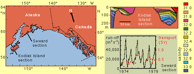
The lower diagram compares river run-off integrated over the Alaskan Pacific coastline (black line) with volume transport of the upper 100 m of the water column across the Seward section (red squares) for 1974 - 1979. Note that the transport of the buoyancy-driven flow follows the variations in river run-off closely but is larger than the river run-off by a factor of 25.
Kodiak Island section adapted from Royer (1982). Map and Seward section adapted from Schumacher and Reed (1986).
contact address: