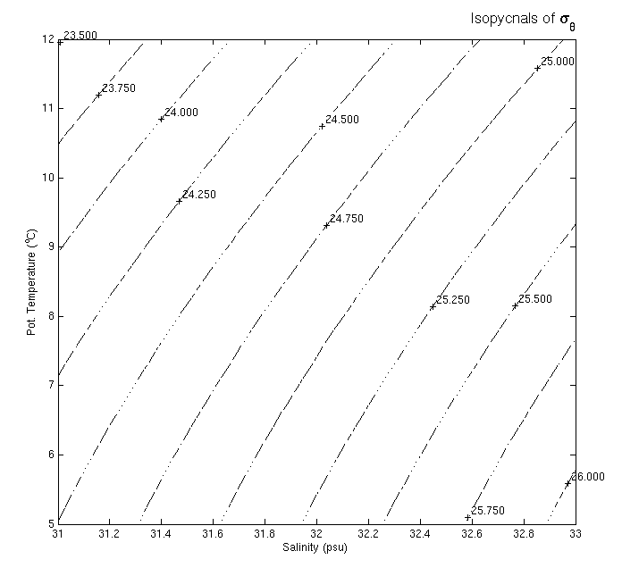
The method by which the core of a water mass is identified is through the use of "property-property" plots, a term indicating that two different chemical or physical properties are charted against one another in a Cartesian (x-y) plot.The most common plot for identifying water mass cores is the T-S plot, which has Salinity as the X-axis and (potential) Temperature as the Y-axis. "T-S space" refers to the visualization of hydrographic station data on such a T-S plot. Also relatively common are T-O (temperature-oxygen) plots.
Please note that when physical oceanographers use the term "temperature", they usually mean potential temperature unless specifically noted otherwise. Similarly, when the term "depth" is used, oceanographers are typically referring to pressure, the directly measured quantity.
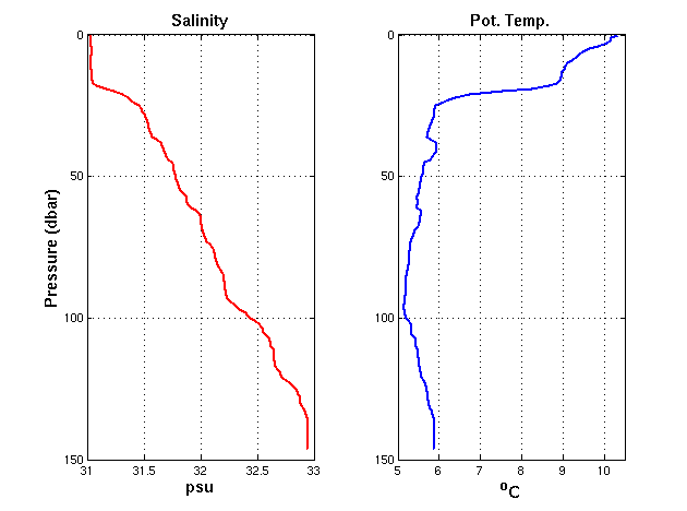
Maine Intermediate Water (MIW) forms when winter cooling mixes the water column in the Gulf of Maine very deeply. This cold, layer of water is capped in summer with a heated surface layer. The core of MIW is the temperature minimum found between this surface layer and the remnant of Slope Water, which is found at the bottom of the water column in the Gulf of Maine with a salinity and temperature of approximately 33 psu and 6 C.