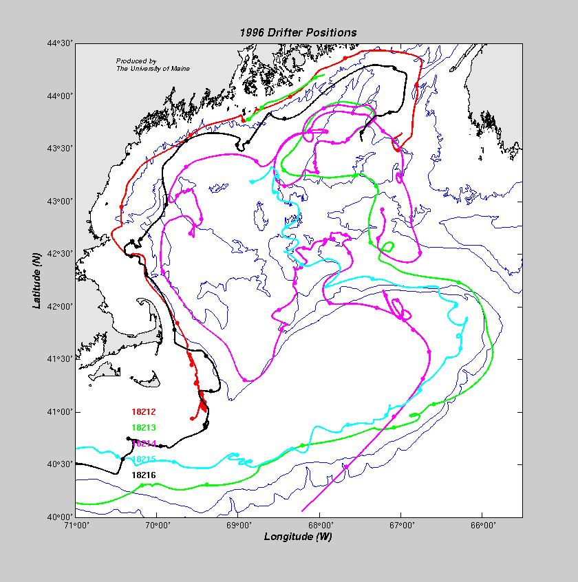
Drifting Buoys, RMRP 1996
Drifting Buoy Information:
Four satellite tracked drifting buoys were deployed between 10-13 May 1996 by the RV Argo Maine.
One buoy (ptt 18213) was picked up by a fishing vessel near Rockland in early June 1996 and was subsequently
redeployed on 4 August at 43° 34.3´N, 067° 39.54´W. The fifth drifting buoy was
deployed on 6 August.
All five had drogues at a depth of 40 meters. The drifting buoys transmitted via Service Argos
on a limited duty cycle and between 1-3 positions were received daily for most of the buoys. The
table below lists the deployment positions along with the date and position of
the last transmission.
Data Processing:
The positions calculated by Service Argos were edited using a default speed
criterion of 6 knots, eliminating unrealistic positons. The cleaned time series
were fit by a cubic spline and interpolated to hourly positions. The hourly
positions were low-pass filtered to remove any tidal effects.
Data Display:
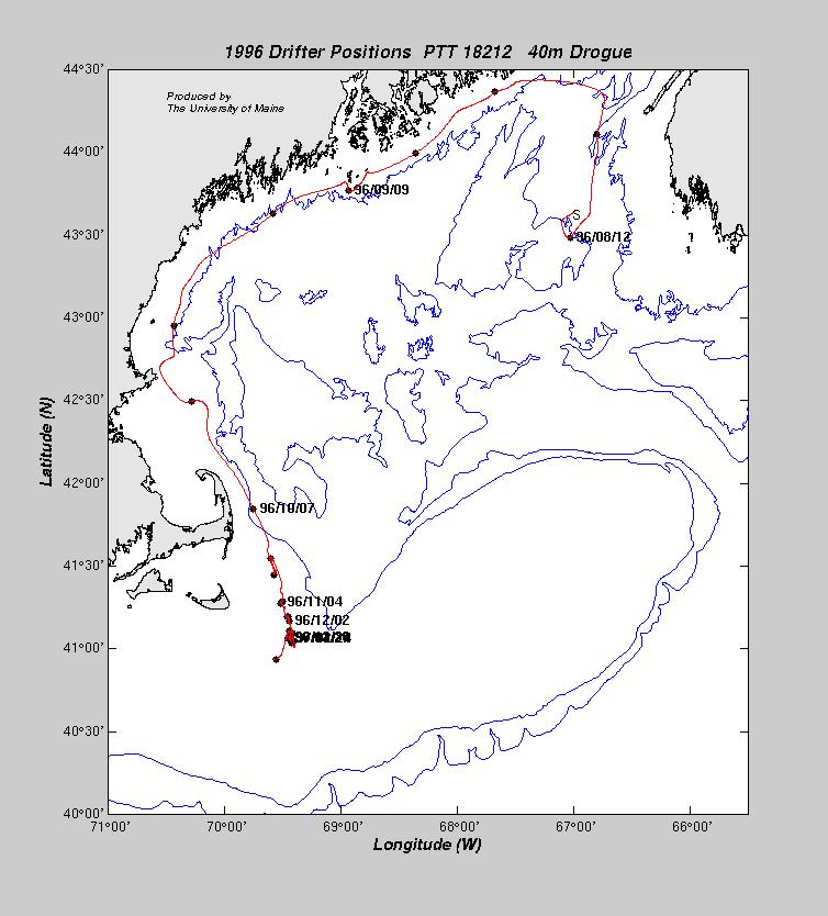
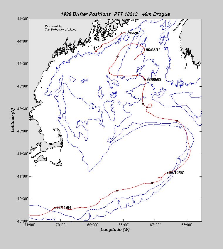
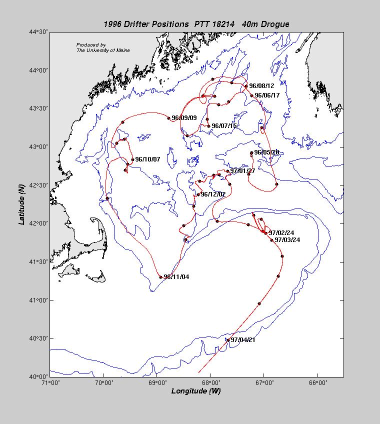
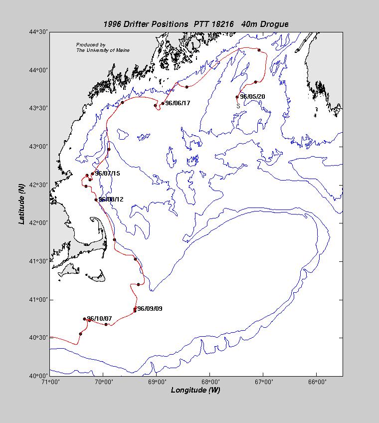
The smoothed position time series are shown for each buoy. The symbols on the
plots are every seven days, starting from 02 May 1994 at 0000z. Labels indicating
the date are placed every four weeks.
| PTT | Drogue Depth | Date Deployed | Latitude | Longitude | Last Date | Latitude | Longitude |
| 18212 | 40 m | 08 Aug 1996 | 44° 16.0´N | 67° 27.1´W | 09 Apr 1997 | 40° 57.4´N | 69° 37.9´W |
| 18213 | 40 m | 11 May 1996 | 44° 27.9´N | 67° 17.0´W | 12 Apr 1997 | 44° 12.0´N | 45° 48.9´W |
| 18214 | 40 m | 13 May 1996 | 42° 55.0´N | 67° 14.1´W | 30 Mar 1997 | 39° 56.6´N | 68° 22.1´W |
| 18215 | 40 m | 10 May 1996 | 43° 56.7´N | 67° 30.2´W | 13 Apr 1997 | 31° 58.1´N | 55° 31.9´W |
| 18216 | 40 m | 11 May 1996 | 43° 32.9´N | 67° 40.0´W | 15 Apr 1997 | 32° 00.4´N | 44° 05.2´W |