
| Event | Date | Time UTC | Latitude | Longitude | Depth | Location |
| Depart Portland | 04/23/00 | 13:00 | - | - | - | Start of CH-09 |
| USGS01 Mooring | 04/23/00 | 19:32 | 43° 36.67´N | 69° 51.89´W | 17 | Cape Small |
| USGS02 Mooring | 04/24/00 | 01:47 | 43° 42.03´N | 69° 21.29´W | 99.6 | Monehgan Inshore |
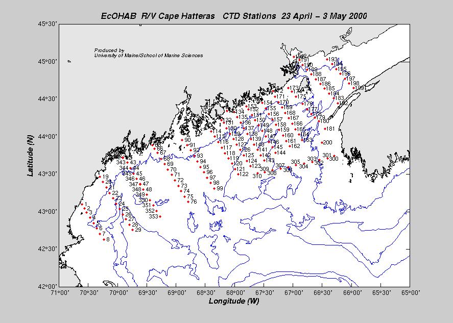
| CTD1 | 04/24/00 | 13:00 | 43° 06.12´N | 70° 36.69´W | 219.0 | Start of Stations |
| DRIFT1 | 04/28/00 | 08:00 | 44° 00.13´N | 68° 20.12´W | 93 | |
| DRIFT2 | 04/28/00 | 08:43 | 43° 55.85´N | 68° 16.63´W | 112 | |
| DRIFT3 | 04/29/00 | 16:53 | 44° 17.69´N | 67° 42.19´W | 72 | |
| CTD342 | 05/03/00 | 11:02 | 43° 43.51´N | 69° 54.44´W | 25.0 | End of Stations |
| Arrive Portland | 05/03/00 | 12:00 | - | - | - | End of CH-09 |
| Dave Townsend, Chief Scientist | U. Maine |
| John Wallinga | U. Maine |
| Abby Deitz | U. Maine |
| Megan DiPirro | U. Maine |
| Ryan Weatherbee | U. Maine |
| Stephanie Bennett | U. Maine |
| Jason Hyatt | USGS |
| Becky Clauss | U. New Hampshire |
| Marie Evans | UNH/U.Mass |
| Jeff Turner | U. Mass. |
| Sean Buckley | U. Mass. |