EcOHAB 1998 PhOG Field Work
EcOHAB 1998 PhOG Field Work |
|
This experiment primarily focused its efforts on the coastal and near-coastal waters of the Gulf of Maine
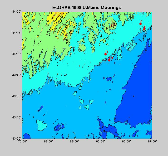
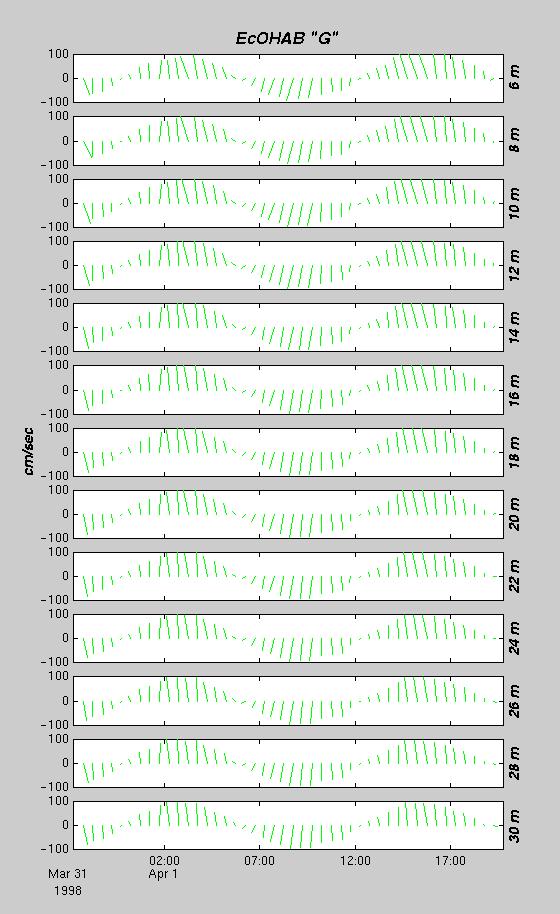
The University of Maine deployed four "slack" moorings within the 100 meter isobath
(Mooring Locations). These moorings
were designed to sample the water column at discrete time intervals and average the data to half
hourly values using 300 kHz ADCPs manufactured by R.D. Instruments, Inc.
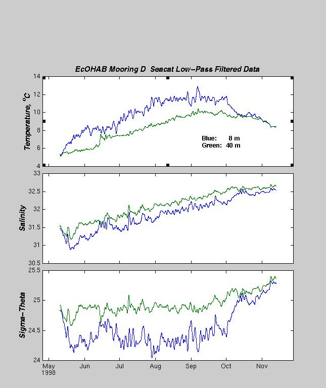
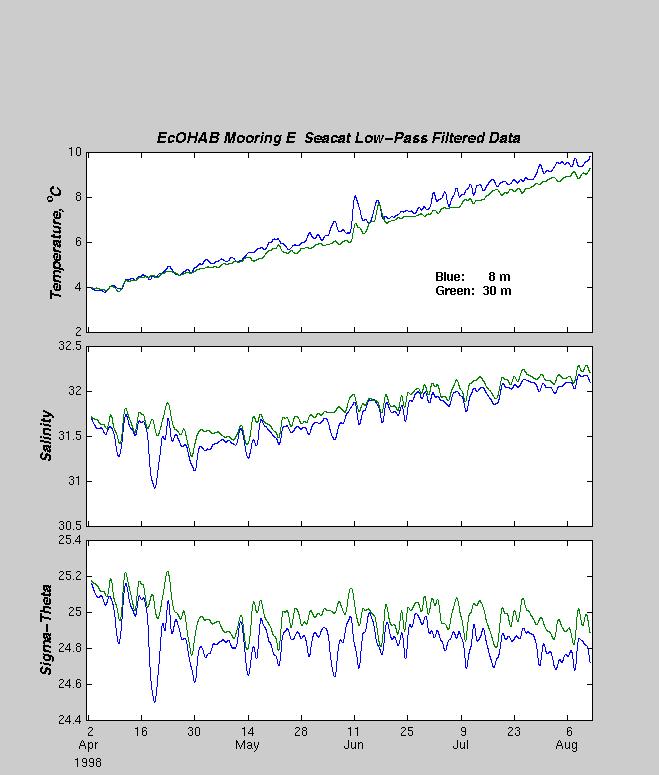
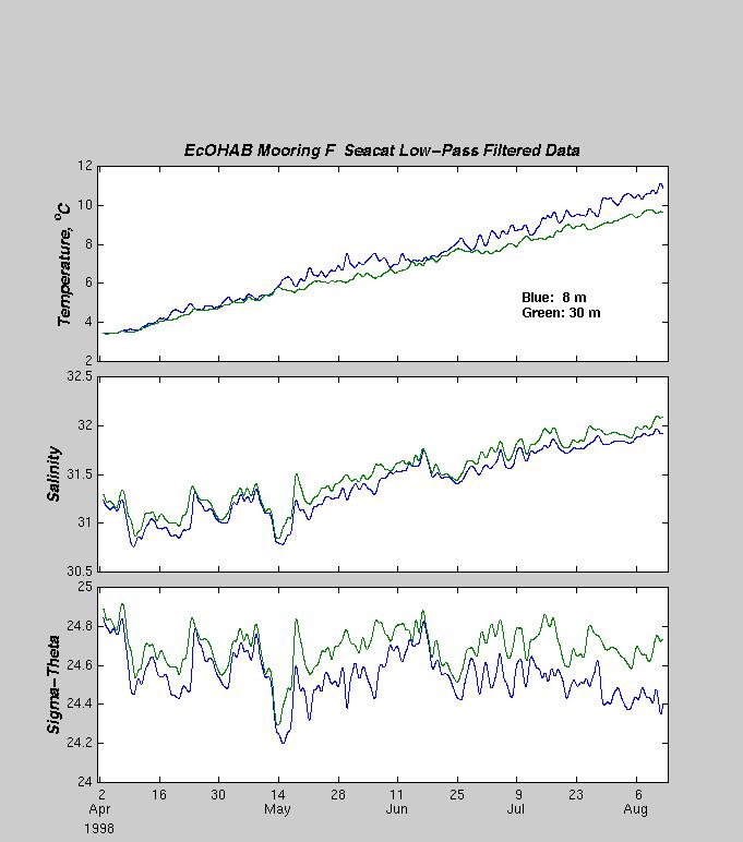
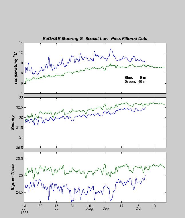
At depths of 8 and 30 meters (40 meters on Buoys D and G1), a Seabird Seacat T/S instrument
was attached to the mooring wire and sampled at a rate of one sample
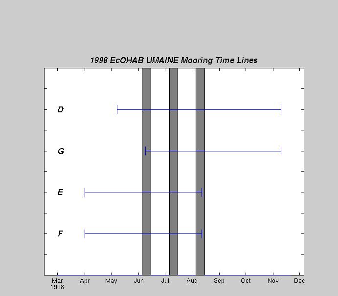
every 15 minutes. The mooring deployment period was between
April and November 1998. Mooring G was inadvertantly recovered by the Canadian Coast Guard
one day after it was deployed; mooring G1 was deployed in June to replace G.
The mooring locations are as follows:
| BUOY | Data | Latitude | Longitude | Depth | Deploy. Date | Recov.Date | Comments |
| D | Vel,T/S | 44° 00.60´N | 068° 23.47´W | 83m | 9 May 1998 | 14 Nov 1998 | OK |
| E | Vel,T/S | 44° 17.44´N | 067° 40.02´W | 99m | 1 Apr 1998 | 13 Aug 1998 | OK |
| F | Vel,T/S | 44° 21.45´N | 067° 43.35´W | 64m | 1 Apr 1998 | 13 Aug 1998 | OK |
| G | Vel | 43° 47.41´N | 066° 22.67´W | 63m | 31 Mar 1998 | 1 Apr 1998 | Buoy drug up by Can.CG |
| G1 | Vel,T/S | 43° 55.79´N | 068° 19.48´W | 119m | 11 Jun 1998 | 14 Nov 1998 | Redeployed original buoy G |
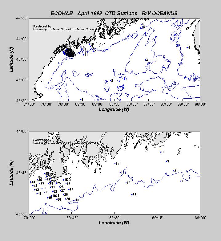
Hydrographic surveys were conducted on four separate cruises, spaced approximately one month apart. The first cruise, March 30 - April 3, 1998, was primarily a mooring deployment cruise with limited CTD coverage in the Gulf, and higher resulution sampling in and around Casco Bay.